- 3:44 h
- 64.89 km
- 254 m
- 360 m
- 86 m
- 300 m
- 214 m
- Start: Bad Driburg train station
- Destination: Höxter station
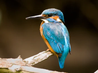
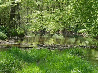
In many areas, the Nethe floodplain has retained its natural character to this day. Kingfishers breed in the steep banks, colourful iridescent dragonflies dance across the water and trout, grayling and brook lamprey spawn on the gravel banks. Lush tall herbaceous meadows and narrow gallery forests provide a habitat for the grasshopper warbler and nightingale. And in many places in the hinterland, a historically evolved, small-scale cultural landscape with quiet villages adjoins.
Waypoints
Good to know
Pavements
Best to visit
Directions
You can end your ride at the terminus or at the intermediate stations of Willebadessen, Brakel, Ottbergen and Godelheim and return to your starting point by train. The route passes through several villages with catering facilities. There are also various places to eat and drink. At weekends, the bistro at the Weidenpalais in Rheder is also usually open. There are various places to picnic - at picnic areas or on a picnic blanket on the banks of the Nethe.
The following describes the route downstream, from Bad Driburg station to Höxter station.
After Willebadessen, the trail approaches the course of the Nethe. There are also places to picnic at the edge of the extensive meadows. You cross the Nethe at kilometer 20 and cycle parallel to the district road, albeit slightly below it, so that the sporadic traffic does not disturb you any further. Between Gut Haversen and Fölsen there is a gravel section about 200 m long, but it is easy to cycle on. In Fölsen, a little caution is advised when crossing the road, then continue on a quiet path through the Nethe floodplain, which is framed here by meadows and pastures.
Now it is only 2.5 km to the "Weidenpalais im Nethetal". Just after entering Rheder, leave the cycle path to the left and take the signposted alternative route through the landscape park. You should definitely take a look at the lively Weidenpalais building. It was built in around 6 weeks by 300 helpers using only muscle power and is now greening itself. The extensive surrounding meadow and the riverbank on the Nethe call for a rest. The restaurant is open at weekends.
In the landscape park, you move a little away from the Nethe again and follow the barely used and ascending road towards Riesel. The B252/B64 intersection is very close here, but does not interfere with us on the cycle path; we pass under the roads through small tunnels and are guided away from them.
Another nice picnic spot awaits at the Nethe bridge near Brakel, also with a sunbathing lawn and riverbank. After passing Brakel, the route crosses a daring-looking wooden bridge and crosses under the B64 again, followed by an approx. 200m long ascent and an equally long descent. At the information board, it is worth taking a detour to the left onto the farm track, which reaches the banks of the Nethe after 150m. Here you will find a sunny picnic area with the option of descending into the water.
Crossing the town of Erkeln requires a little attention, as you have to cycle on the main road for around 50 m before the path continues into the Nethe floodplain towards Hembsen. Here, too, there is another bridge, this time with a shady picnic area and a children's playground. As you continue in the direction of Bruchhausen/Ottbergen, you cross the "Kalkmagerrasen bei Ottbergen" adventure area. The cycle path here is part of the 13 km long circular hiking trail "Wege der Vielfalt" (Paths of Diversity) over the heights on both sides of the Nethe Valley. If you follow the road in Ottbergen behind the village church for approx. 50 m in a southerly direction, you will reach another lovely picnic area right by the river. However, the cycle path leads you to the left towards Amelunxen. Here you cross under the Ottbergen-Göttingen railroad line, which leads over an impressive steel bridge.
A little caution is again required when passing through Amelunxen, as cars and bikes have to share the road. The route then leads flat through the Feldmark, past the outskirts of Godelheim to the Nethe estuary adventure area - with a refuge, landscape loungers and access to the water, it is ideal for a rest. This is where the Nethelauf ends at the mouth of the Weser and the cycle path joins the busy Weser long-distance cycle path.
Now you are just 5 km from your destination of Höxter. On the left is the Godelheimer Seen recreational area with campsite and bathing areas, on the right is the Weser and you have a view of attractive estates on the banks of the Weser in Boffzen. If you want to wash off the sweat from the tour, you should take the opportunity to do so at the bathing lake, which even has a sandy beach here - Höxter train station is just one kilometer away.
Tour information
Familiy-Friendly
Good Connection to public Transport
Labelling
Possibility of Accommodation
Stop at an Inn
Suitable for Bike
Equipment
Directions & Parking facilities
Additional information
Contact person
License (master data)
Höxter district
Safety guidelines


